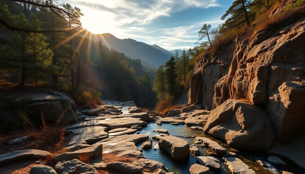
The crisp scent of damp earth and ancient sycamores fills the air as you descend into the canyon, the gentle roar of water growing louder with each step. This is the prelude to an encounter with the magnificent Santa Anita Sturtevant Falls, a spectacular 50-foot cascade that plunges into a pristine grotto, a serene oasis hidden within the rugged San Gabriel Mountains. Sunlight filters through the dense canopy, dappling the moss-covered rocks and illuminating the spray, creating a truly enchanting spectacle that rewards every effort of your journey.
Trail Specifications
Trail Name: Santa Anita Sturtevant Falls Trail
Location: Chantry Flat Recreation Area, Arcadia, CA
Distance: Approximately 3.3 miles round trip (out and back)
Elevation Gain: Approximately 650 feet
Difficulty: Moderate
GPS Coordinates (Trailhead): 34.2057° N, 118.0416° W
Best Season: Year-round, especially after rainfall for optimal falls flow
Dog-Friendly: Yes, dogs must be on a leash
Route Overview & Natural Highlights
The journey to Sturtevant Falls takes you deep into the heart of Big Santa Anita Canyon, a lush riparian corridor carved into the ancient granitic bedrock of the San Gabriel Mountains. The trail itself is a well-maintained path, often shaded by a dense canopy of Coast Live Oak (Quercus agrifolia) and towering California Sycamore (Platanus racemosa), their distinctive mottled bark a signature feature. You’ll navigate gentle descents and ascents, crossing the Big Santa Anita Creek multiple times via sturdy wooden bridges or rock hops, depending on water levels. Keep an eye out for the delicate fronds of Maidenhair Ferns clinging to damp rock faces and the vibrant red berries of Toyon shrubs.
The ecology here is surprisingly diverse for an urban-adjacent wilderness. The constant presence of water from the creek supports a rich array of plant life, including Western Redbud (Cercis occidentalis) which bursts with magenta blooms in spring, and various wildflowers like Canyon Sunflower. Birdsong is a constant companion, with Western Scrub-Jays, California Quail, and various warblers flitting through the undergrowth. You might also spot lizards sunning themselves on warm rocks, or even a deer pausing at the creek’s edge. The geological formations along the trail showcase the erosive power of water over millennia, with smooth, water-worn boulders and exposed granite outcrops telling tales of the mountains’ formation.
Turn-by-Turn Trail Breakdown
Trailhead Start: The Chantry Flat Descent
Your adventure begins at the historic Chantry Flat Recreation Area. From the parking lot, you’ll immediately encounter a paved, but very steep, descent. This initial stretch, approximately half a mile long, loses significant elevation quickly, so be mindful that you’ll be climbing it on your return. As you descend, you’ll pass numerous private cabins, a charming glimpse into the canyon’s unique history as a mountain retreat. The paved road eventually transitions into a well-defined dirt trail as you reach the bottom of the canyon and the first crossing of the Big Santa Anita Creek.
Mid-Trail Features: Canyon Serenity & Cabin History
Once you’ve reached the canyon floor, the trail flattens out considerably, following the winding course of the creek. This section, part of the larger Gabrielino Trail, is characterized by its lush riparian vegetation and numerous creek crossings. You’ll traverse several charming wooden bridges, and during periods of higher flow, you might need to carefully rock-hop across shallower sections. Along this stretch, you’ll continue to encounter more of the historic private cabins, some dating back to the early 20th century, adding a unique cultural layer to your nature walk. The air here is often cooler and more humid, a welcome respite on warmer days, and the sounds of the creek are ever-present.
Summit/Destination & Return: Sturtevant Falls Reward
As you near the destination, the trail begins a gentle uphill climb, signaling your approach to Sturtevant Falls. The path narrows slightly, winding through denser foliage before opening up to reveal the stunning 50-foot waterfall. The grotto at the base of the falls offers a perfect spot to rest, enjoy a snack, and absorb the cool mist and the tranquil sounds of the cascading water. Take time to explore the area around the falls, perhaps finding a smooth rock to sit on. When you’re ready to depart, simply retrace your steps back along the same trail. Remember the initial steep ascent back to the Chantry Flat parking lot, which will be the most demanding part of your return journey.
Seasonal Guide & Best Times
- Spring (March – May): Arguably the best time. Wildflowers are in bloom, the creek flows strongly from winter rains, and the weather is pleasantly mild. Expect vibrant greenery.
- Summer (June – August): Can be warm, but the canyon’s shade provides some relief. The falls may have reduced flow, but the creek offers opportunities for cooling off. Start early to beat the heat and crowds.
- Autumn (September – November): A beautiful time as sycamores and oaks begin to show fall colors, especially in late October and early November. Temperatures are comfortable, and crowds thin out slightly.
- Winter (December – February): Excellent for robust waterfall flow, especially after rainstorms. The air is crisp and clear. Be prepared for potentially muddy sections and cooler temperatures.
Essential Gear & Safety
- Wear sturdy hiking shoes with good traction, especially for creek crossings and the steep paved section.
- Carry plenty of water (at least 2 liters per person) and snacks. There are no services on the trail.
- Sun protection (hat, sunscreen) is advisable for exposed sections, even in the shaded canyon.
- Be aware of poison oak, which is common in the canyon. Learn to identify it and avoid contact.
- Always let someone know your hiking plans and estimated return time.
- For more details and recent trail conditions, check AllTrails: Sturtevant Falls Trail.
Getting There & Parking
To reach the Santa Anita Sturtevant Falls trailhead, navigate to the Chantry Flat Recreation Area in Arcadia, CA. From the 210 Freeway, take the Santa Anita Avenue exit and head north. Continue on Santa Anita Avenue as it winds up into the foothills, becoming a narrow, winding mountain road. The road ends at the large parking lot for Chantry Flat. Be aware that this parking lot fills up very quickly, especially on weekends and holidays, so arrive early (before 7 AM is recommended). A National Forest Adventure Pass is required for parking ($5/day or $30/year) and can often be purchased at the small general store near the parking lot entrance if it’s open, or in advance from authorized vendors. Restrooms and picnic tables are available at the Chantry Flat area.
Curated Literature & Los Angeles Downtown Calendar
The Architecture of Focus: Deep Work & Modern Mastery
By Founders Library Press
A structured framework for strategic clarity, productivity, and authentic execution.
Upcoming Downtown Happenings
Live acoustic sessions, gallery receptions, literary salons, and independent trade shows across Los Angeles.
