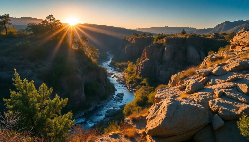
The cool, clear waters of the San Gabriel River rush over smooth stones, a constant, soothing murmur accompanying your every step as you venture deeper into the canyon. Towering granite walls rise on either side, sculpted by millennia of water and wind, hinting at the wild beauty that awaits. Your journey along the Bridge to Nowhere River Trail promises not just a hike, but an immersion into a landscape where nature reclaims its dominion, culminating in a historic, isolated archway that sparks the imagination.
Trail Specifications
- Trail Name:
- Bridge to Nowhere River Trail
- Location:
- Azusa, CA (Angeles National Forest)
- Distance:
- 10 miles (out-and-back)
- Elevation Gain:
- Approximately 1,000 feet
- Difficulty:
- Moderate to Strenuous
- GPS Coordinates:
- 34.2375° N, 117.8422° W (Trailhead Parking)
- Best Season:
- Spring and Fall
- Dog-Friendly:
- Yes, on leash
Route Overview & Natural Highlights
This extraordinary trail plunges you into the heart of the San Gabriel Mountains, a rugged range forming part of the San Gabriel Mountains National Monument. The path is defined by the San Gabriel River, which you will cross numerous times—expect anywhere from six to ten crossings depending on water levels and your route choices. The terrain varies from well-worn dirt paths to sections of rock-hopping and wading through the river itself. The canyon walls, composed primarily of ancient granitic rock, display fascinating geological patterns, with veins of quartz visible in places.
The ecology here is a striking blend of riparian and chaparral ecosystems. Along the riverbanks, you’ll find a lush corridor of western sycamores (Platanus racemosa) with their distinctive mottled bark, towering Fremont cottonwoods (Populus fremontii), and various willow species, providing welcome shade and a habitat for diverse birdlife. Keep an eye out for red-tailed hawks circling overhead or the quick flash of a canyon wren. Higher up the slopes, the drier chaparral includes fragrant California sagebrush (Artemisia californica), ceanothus, and manzanita, their resilience a testament to the region’s Mediterranean climate. Mule deer are common, and if you’re fortunate and quiet, you might spot a bobcat or coyote moving through the underbrush.
Turn-by-Turn Trail Breakdown
Trailhead to the First Crossings: Your adventure begins at the parking area at the end of San Gabriel Canyon Road (Highway 39), just past the entrance to Cogswell Dam. The initial descent is steep but short, leading you down to the riverbed. From here, the trail becomes less defined and more of an intuitive journey upstream. You’ll quickly encounter your first river crossings. Embrace the experience; getting your feet wet is part of the charm. The path winds along the river, sometimes on a clear dirt track, other times requiring you to navigate over rocks or through shallow water. The air is often cooler here, carrying the scent of damp earth and river water.
Mid-Trail Meanderings: As you progress, the canyon narrows and deepens, amplifying the sense of wilderness. The river crossings become more frequent and can range from ankle-deep to knee-deep, especially after heavy rains. Sturdy water shoes with good grip are essential. You’ll pass remnants of old mining activity, subtle reminders of human attempts to tame this wild landscape. Look for small cascades and natural pools, perfect for a refreshing dip on a warm day. The towering sycamores and oaks provide a natural canopy, creating pockets of serene shade, a stark contrast to the sun-baked slopes just above the riparian zone. This section of the trail truly feels remote, with only the sounds of the river and the wind for company.
The Bridge and Beyond: After several miles and numerous crossings, you’ll round a bend and see it—the majestic Bridge to Nowhere, a concrete arch spanning the canyon, seemingly suspended in time. Built in 1936 as part of a road that was never completed due to a devastating flood, it now stands as an isolated monument. Take time to explore the area, soak in the history, and perhaps watch the bungee jumpers if they are operating. The area around the bridge offers flat rock slabs perfect for a picnic lunch. The return journey follows the same path, but the downstream direction often feels quicker. Remember to conserve energy for the final uphill climb back to your vehicle.
Seasonal Guide & Best Times
- Spring (March-May): This is arguably theThe Bookworm CampaignSubtle Comforts • Intentional Living
Curated Literature & Los Angeles Downtown Calendar
Philosophy & Focus Curated EditionThe Architecture of Focus: Deep Work & Modern Mastery
By Founders Library Press
A structured framework for strategic clarity, productivity, and authentic execution.
Los Angeles Calendar Downtown • Arts • CultureUpcoming Downtown Happenings
Live acoustic sessions, gallery receptions, literary salons, and independent trade shows across Los Angeles.
