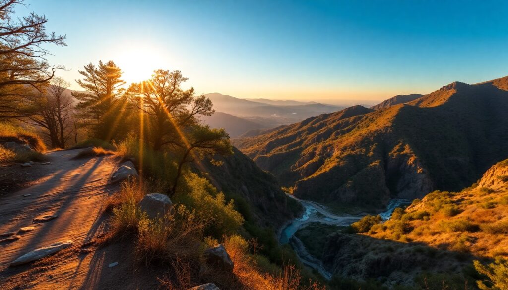
As the morning marine layer begins its slow retreat, revealing the vast expanse of the Pacific Ocean, you feel the inviting warmth of the sun on your skin. A crisp, saline breeze carries the scent of coastal sage, hinting at the adventure ahead. This is the sensory prelude to the Temescal Canyon Ridge Trail, a quintessential Los Angeles experience that rewards your effort with breathtaking panoramas stretching from the Malibu coastline to the distant downtown skyline. Prepare for an invigorating ascent that promises unforgettable views and a deep connection with the Santa Monica Mountains.
Trail Specifications
- Trail Name: Temescal Canyon Ridge Trail (Loop)
- Location: Temescal Gateway Park, Pacific Palisades, CA
- Distance: Approximately 2.6 miles (4.2 km)
- Elevation Gain: Approximately 860 feet (262 meters)
- Difficulty: Moderate
- GPS Coordinates (Parking): 34.0415° N, 118.5444° W
- Best Season: Year-round, but ideal in fall, winter, and spring.
- Dog-Friendly: Yes, on leash.
Route Overview & Natural Highlights
The Temescal Canyon Ridge Trail offers a dynamic journey through the characteristic landscapes of the Santa Monica Mountains. Your path begins in the lush canyon bottom, shaded by mature Western Sycamores (Platanus racemosa) and Coast Live Oaks (Quercus agrifolia), providing a stark contrast to the sun-drenched ridge you will soon ascend. This lower section often features the seasonal Temescal Canyon waterfall, a delightful sight after winter rains, cascading over sandstone formations.
As you climb, the vegetation transitions to classic chaparral and coastal sage scrub. Here, you’ll encounter aromatic California Sagebrush (Artemisia californica), spiky California Buckwheat (Eriogonum fasciculatum), and the vibrant red berries of Toyon (Heteromeles arbutifolia), a native shrub that adds splashes of color in winter. Keep an eye out for local wildlife; Red-tailed Hawks (Buteo jamaicensis) frequently circle overhead, utilizing the thermal updrafts, and you might spot California Quail (Callipepla californica) darting through the underbrush or even a shy Coyote (Canis latrans) traversing the slopes. The geological story of the region is etched into the exposed sedimentary rocks, primarily sandstone and shale, remnants of ancient seabeds uplifted and folded over millions of years.
The true payoff of this trail lies along the ridge, where the panoramic views are simply spectacular. To your west, the Pacific Ocean stretches infinitely, often dotted with sailboats and surfers near Topanga Beach. To the south, the Santa Monica Pier and Palos Verdes Peninsula stand out, while on a clear day, the distant San Gabriel Mountains frame the eastern skyline. It’s a vantage point that beautifully encapsulates the unique blend of urban proximity and wild nature that defines Los Angeles.
Turn-by-Turn Trail Breakdown
The Ascent from Temescal Gateway Park
Your adventure begins at the Temescal Gateway Park trailhead, near the restrooms and picnic areas. You’ll start on the Temescal Canyon Trail, a wide, well-maintained path that follows the canyon floor. Within the first half-mile, you’ll pass the turn-off for the seasonal waterfall (a short detour to your right) and soon after, reach a fork. Take the left path, which begins a steady, switchbacking climb up the canyon wall. This section is shaded initially but quickly opens up, offering glimpses of the canyon below and the distant ocean.
Ridge Walk and Panoramic Vistas
As you gain elevation, the trail narrows slightly and transitions onto the ridge line. This is where the landscape transforms, offering expansive, unobstructed views. You’ll be walking along a sun-exposed path, with the Pacific Ocean dominating your left-hand side and the rolling hills of the Santa Monica Mountains to your right. Look for the distinctive architecture of the Getty Villa to the west, perched above the coastline. This section of the trail is relatively flat in parts, allowing you to fully absorb the incredible scenery before continuing your climb to the highest point.
The Summit and Descent Back to the Canyon
The highest point of the loop provides the most commanding views, a perfect spot for a water break and photos. From here, the trail begins its descent, merging with the Temescal Ridge Trail. You’ll continue along the ridge for a bit longer, with the views persisting, before the path gradually curves inland and begins a steeper descent back into the canyon. The trail here can be a bit loose underfoot, so watch your step. You’ll eventually reconnect with the main Temescal Canyon Trail, completing the loop and leading you back to the parking area. Consider a visit to nearby Will Rogers State Historic Park for a dose of history and more scenic views if you have time.
Seasonal Guide & Best Times
- Spring (March – May): Arguably the best season. Mild temperatures, lush green hillsides, and wildflowers in bloom after winter rains. The seasonal waterfall is often flowing. Expect more crowds, especially on weekends.
- Summer (June – August): Warm to hot, especially mid-day. Start early to avoid the heat. The marine layer can provide cool mornings. Views can be hazy, but sunsets are spectacular. The waterfall is typically dry.
- Fall (September – November): Pleasant temperatures return, often with crystal-clear skies offering the best visibility for expansive views. Fewer crowds than spring. Wildflowers are scarce, but the air is invigorating.
- Winter (December – February): Cool, crisp days are ideal for hiking. After significant rainfall, the canyon becomes verdant, and the waterfall comes alive. Occasional cold snaps, but generally very pleasant.
Essential Gear & Safety
- Carry plenty of water – there are no refilling stations on the trail.
- Wear sturdy hiking shoes with good grip, especially for the rocky or loose sections.
- Protect yourself from the sun with a hat, sunglasses, and sunscreen, as much of the ridge is exposed.
- Bring a light jacket or layers, as coastal breezes can be cool, even on warm days.
- Always inform someone of your hiking plans and estimated return time.
- For more detailed information and recent trail conditions, consult the Temescal Canyon Ridge Trail on AllTrails.
Getting There & Parking
Temescal Canyon Ridge Trail is located within Temescal Gateway Park at 15601 W Sunset Blvd, Pacific Palisades, CA 90272. The park is easily accessible from Sunset Boulevard. There is a large paved parking lot available. Parking fees apply, typically $12 for the day (subject to change, so bring cash or be prepared for card payments). The park generally opens at 6:00 AM and closes at sunset, though specific hours can vary seasonally. Always check official Los Angeles County Parks & Recreation websites for the most current information regarding hours and fees before your visit.
Curated Literature & Los Angeles Downtown Calendar
The Architecture of Focus: Deep Work & Modern Mastery
By Founders Library Press
A structured framework for strategic clarity, productivity, and authentic execution.
Upcoming Downtown Happenings
Live acoustic sessions, gallery receptions, literary salons, and independent trade shows across Los Angeles.
